Taxes, FSA Data & Property Info
Estimated Net Taxes
$2,724
FSA Data
DCP Cropland: 100.92 acres
CRP: 74.41 acres
Effective DCP Cropland: 26.51 acres
CRP Data
Conservation Reserve Program (CRP)
Contract 3354 5.0 acres @ $261.60/acre: $1,308.00 Expires: Sept. 30, 2025
Contract 3355 10.0 acres @ $261.60/acre: $2,616.00 Expires: Sept. 30, 2025
Contract 11006 1.2 acres @ $314.48/acre: $377.00 Expires: Sept. 30, 2024
Contract 11011 7.4 acres @ $319.32/acre: $2,363.00 Expires: Sept. 30, 2024
Contract 11230 15.84 acres @ $367.45/acre: $5,820.00 Expires: Sept. 30, 2027
Contract 11231 34.96 acres @ $373.21/acre: $13,047.00 Expires: Sept. 30, 2027
Total Acres Enrolled: 74.4 acres
Total Annual Payment: $25,531.00
Average Rental Rate: $343.16 per acre
CSR2: 63.1 per AgriData on Entire Farm
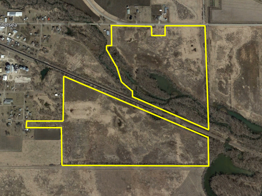
Legal Description
Tama County – 125.8 acres m/l lying East of the Creek in the NE 1⁄4 NW 1⁄4, NW 1⁄4 NE 1⁄4 Except Beginning 219.9' East of Northwest Corner, East 356.5', South 370', West 346.18', North 358.9' to Point of Beginning, SW 1⁄4 NE 1⁄4 Except Rail Road, SE 1⁄4 NW 1⁄4 Lying South of Rail Road, South of Rail Road in the NE 1⁄4 NW 1⁄4 & Lot 4 in the SW 1⁄4 NW 1⁄4, all in Section 17, Township 82 North, Range 13 West of the 5th P.M., Tama County, Iowa.
Property Location
Directions from Chelsea
To access fields north of the railroad, travel east of Chelsea on Highway E66 approximately 0.5 miles and subject property will be on the south side of the pavement. To access fields south of the railroad, from V18 pavement turn east onto Walnut Street and travel to Orange Street. Turn south onto Orange Street and subject property will be on the east side of the Street.
Property Location